
Using Maps as Overlays
You can use the explorer tile maps and the heatmap as overlays elsewhere. For that, use the following URLs:
For the base layers, you can use these URLs:
http://localhost:5000/tile/grayscale/{z}/{x}/{y}.png
http://localhost:5000/tile/pastel/{z}/{x}/{y}.png
http://localhost:5000/tile/color/{z}/{x}/{y}.png
http://localhost:5000/tile/inverse_grayscale/{z}/{x}/{y}.png
For the explorer tiles, you can use these:
http://localhost:5000/explorer/14/tile/{z}/{x}/{y}.png?color_strategy=colorful_cluster
http://localhost:5000/explorer/14/tile/{z}/{x}/{y}.png?color_strategy=max_cluster
http://localhost:5000/explorer/14/tile/{z}/{x}/{y}.png?color_strategy=first
http://localhost:5000/explorer/14/tile/{z}/{x}/{y}.png?color_strategy=last
http://localhost:5000/explorer/14/tile/{z}/{x}/{y}.png?color_strategy=visits
http://localhost:5000/explorer/14/tile/{z}/{x}/{y}.png?color_strategy=missing

http://localhost:5000/explorer/17/tile/{z}/{x}/{y}.png?color_strategy=colorful_cluster
http://localhost:5000/explorer/17/tile/{z}/{x}/{y}.png?color_strategy=max_cluster
http://localhost:5000/explorer/17/tile/{z}/{x}/{y}.png?color_strategy=first
http://localhost:5000/explorer/17/tile/{z}/{x}/{y}.png?color_strategy=last
http://localhost:5000/explorer/17/tile/{z}/{x}/{y}.png?color_strategy=visits
http://localhost:5000/explorer/17/tile/{z}/{x}/{y}.png?color_strategy=missing
The track of the most recent activity that discovered a tile at a given zoom level is available as a red line in its own layer. Append ?activity_id=… to draw a specific activity instead:
http://localhost:5000/explorer/14/latest-new-tiles-activity/{z}/{x}/{y}.png
http://localhost:5000/explorer/17/latest-new-tiles-activity/{z}/{x}/{y}.png
And for the heatmap, you can use these:
http://localhost:5000/heatmap/tile/{z}/{x}/{y}.pngAdding them to Bikerouter
Go to Bikerouter and then you can add these as overlay layers. I show it here with the explorer tiles on zoom 17 with the "colorful cluster" strategy:
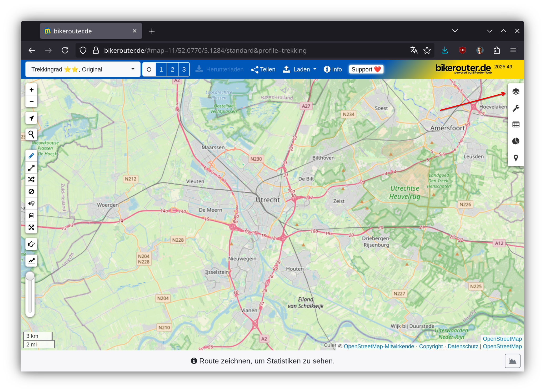
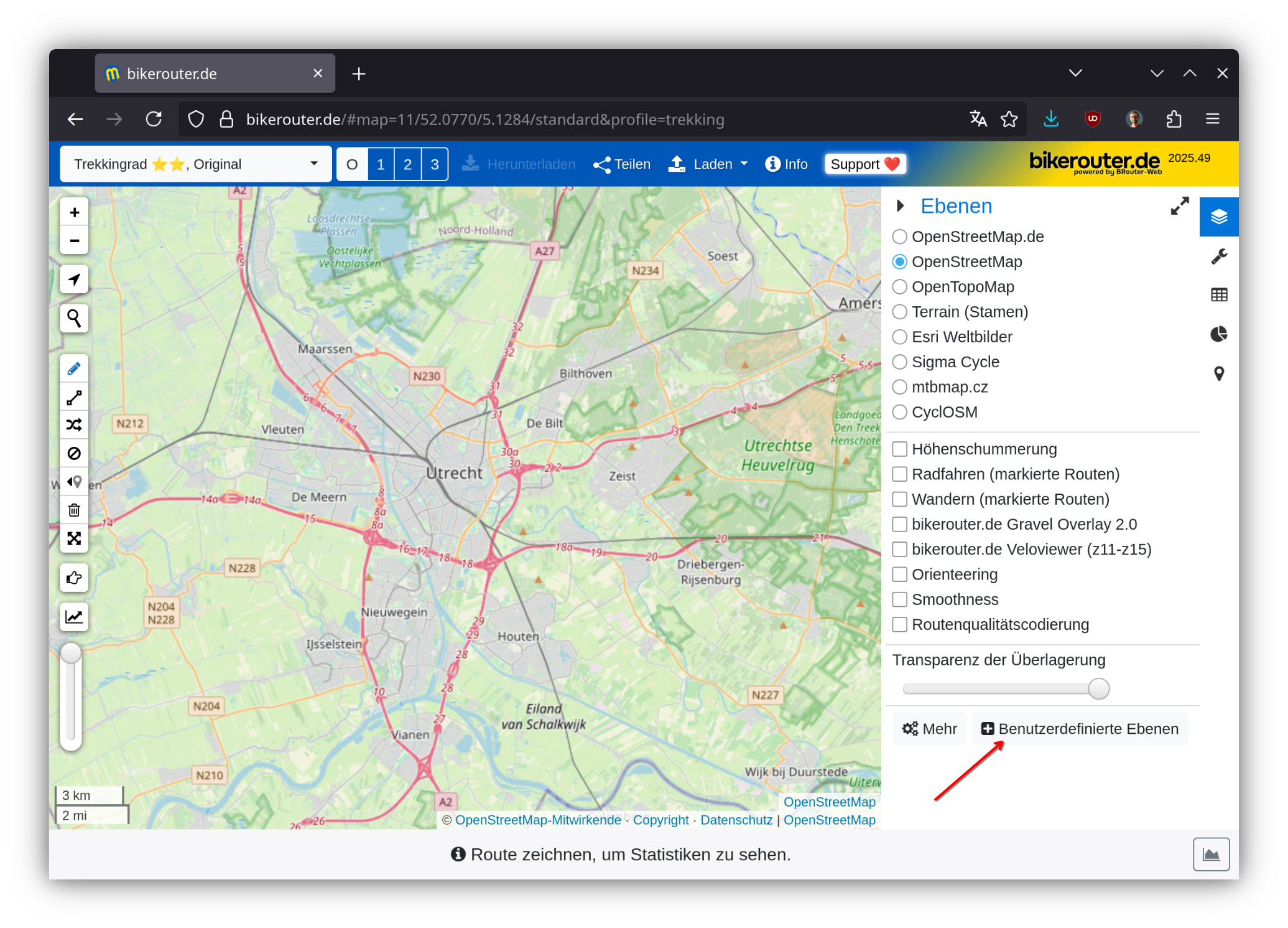
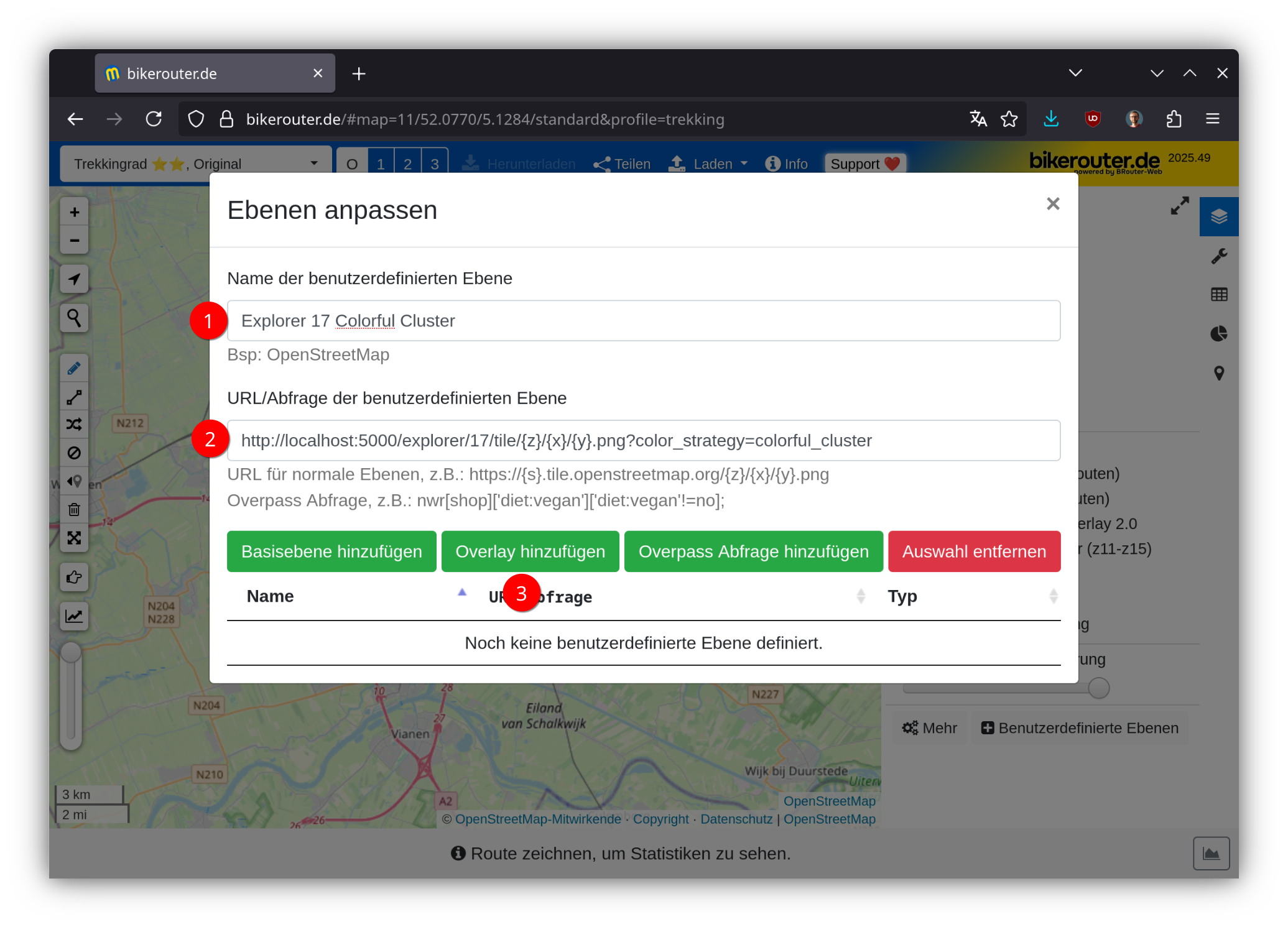
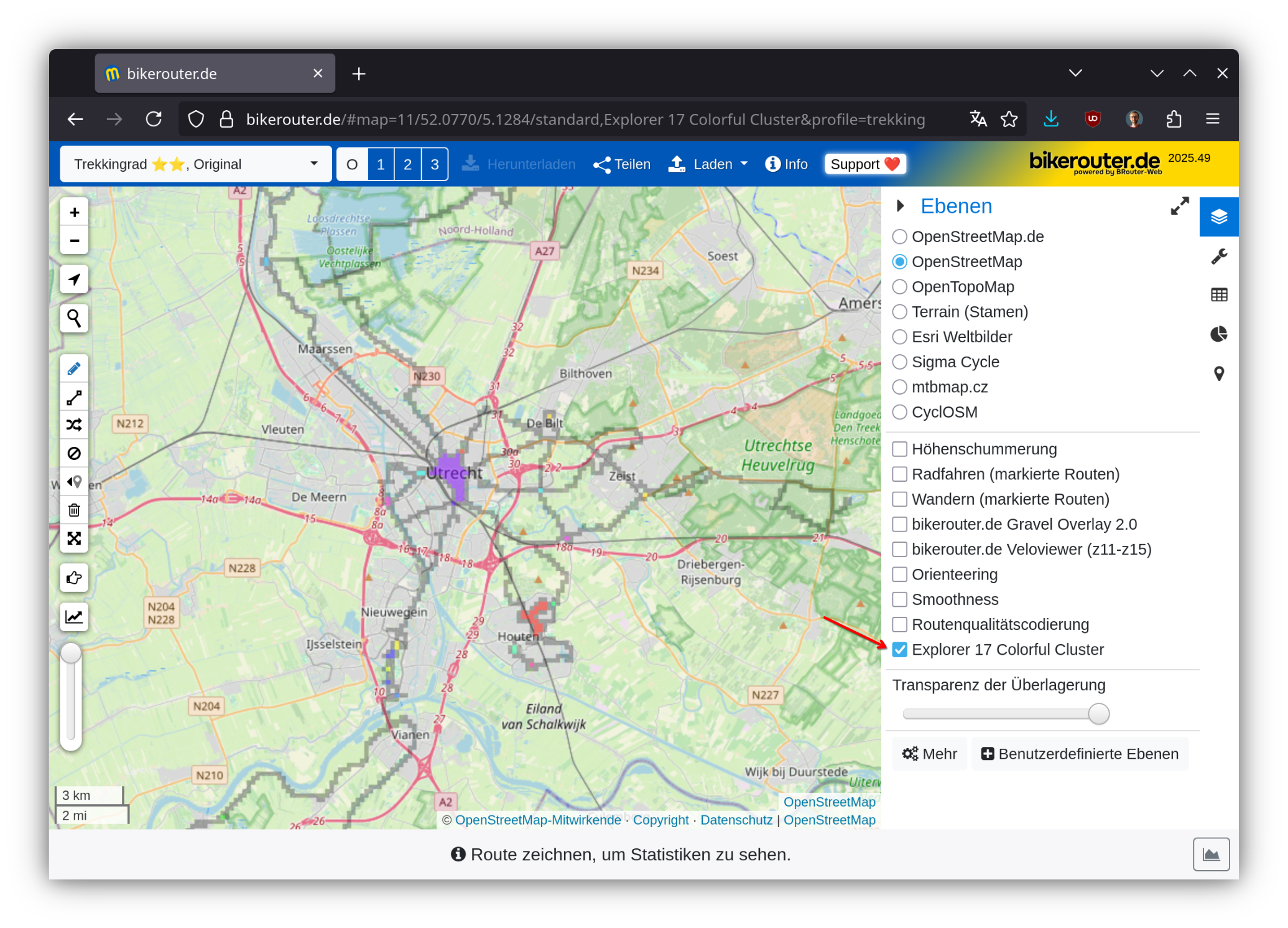
And now you can plan routes with your explorer tiles overlaid. Or add the heatmap. Or both.
Style JSON endpoint for MapLibre GL clients
For applications that consume a MapLibre GL style document rather than a plain tile URL (e.g. Wanderer), GAP can generate one on the fly:
http://localhost:5000/explorer/{zoom}/style.json?color_strategy={strategy}If map_style_url is set in config.json, that style is fetched and extended with a gap-explorer-{zoom}-{strategy} source and matching raster layer. Otherwise a minimal raster style is generated using the configured map_tile_url as the base layer. Both the style and the underlying explorer tile endpoints send Access-Control-Allow-Origin: *, so external browser-based map applications can fetch them directly.
Maps and Layers on-the-go
You might concider using a VPN to get the latest version of your missing explorer tiles when you are on-the-go. One example is Using Docker Compose with Tailscale VPN.