
Plan Missing Tile Rides
Looking at these maps with explorer tiles you can see the gaps. And if you feel challenged to fill those, you might want to plan a “tactical bike ride” to explore those. In this how-to guide you will learn how to export the missing tiles, plan a route and get navigated along it.
Missing tile files
Let us take another look at my tile history in Sint Annaland:
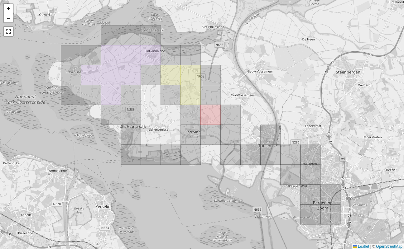
You can see those gaps in the clusters. To plan a route through them, export a file with the missing tiles. Pan and zoom the map to the area which you want to export, then use the link below the map:
Download missing tiles in visible area as GeoJSON.
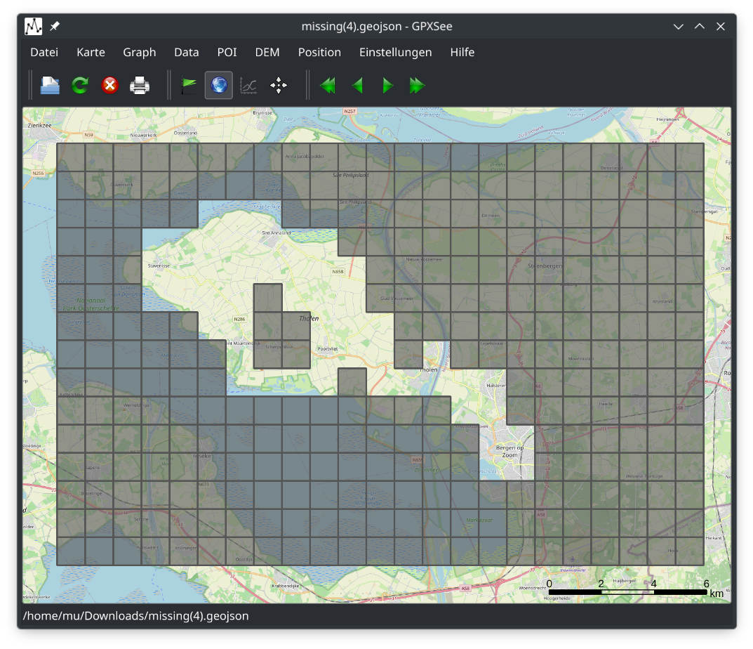
Opened with GPXSee on Linux, the GeoJSON file looks like this:
Upload the GeoJSON file to Bikerouter and it will display there:
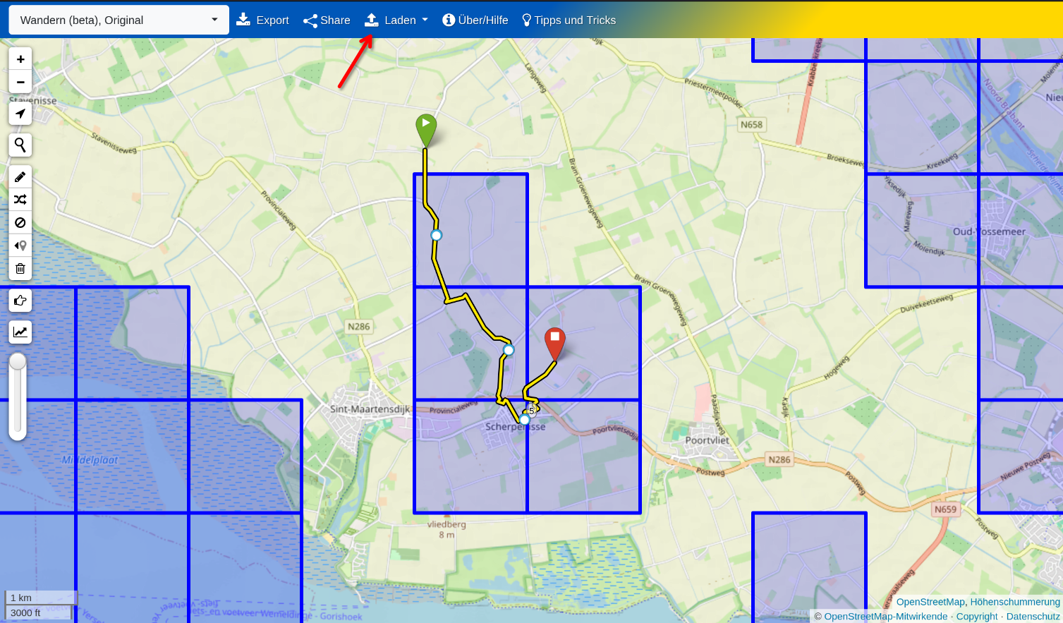
Then plan a route that goes through as many tiles as possible. Download the route as GPX and use an app like OsmAnd to ride along it. To carry the missing tiles themselves along for spontaneous hunting, see Explorer Tiles on the Go.
Excluding inaccessible tiles
Some missing tiles cannot be reached, say because they only contain water or restricted area. You can mark such tiles as inaccessible by clicking them on the explorer tile map. Tiles marked that way count as neither missing nor visited, so they are left out of the downloads described here as well as those of the square planner. Your routing app then doesn't suggest chasing them.
Tiles are marked per zoom level, so marking a tile on the zoom 14 map does not mark the corresponding zoom 17 tiles.
By default an inaccessible tile still blocks a cluster or a square from growing, because it is simply not covered. Under Settings → Explorer Tiles you can let inaccessible tiles count toward cluster and square geometry. They never count as visited tiles, so your explored tile counts stay honest and the map keeps drawing them in the inaccessible style. Counting them is off by default, which is the stricter game.
Inaccessible tiles are counted from the origin of time, as if they had always been covered. Switching this on therefore also changes the past in the cluster and square evolution plots.
Square planner
From the explorer tile views you can open the square planner which allows you to see which tiles you need to explore in order to extend the square into a particular direction. The screen will open with the largest square that you have, then you can use the buttons to extend or move your square.
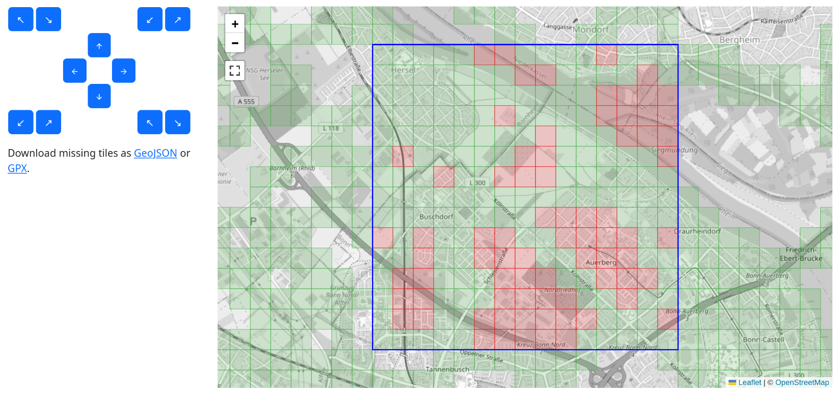
Using the buttons in the middle you can move the square, the buttons in the corners allow to extend or shrink the square.
When you have selected the square that you want to target, you can download the missing files in for that square as GeoJSON or GPX.